GNSS Precise Positioning Solutions
Precise Positioning - GNSS CORS
Professional GNSS positioning system combining Mobile CORS base stations with RTK smartphone receivers for centimeter-level accuracy in surveying, mapping, and geospatial monitoring.
Two-Component GNSS Positioning System
Our precise positioning solution combines two essential products: the GNSS Mobile CORS reference station and the Smartphone GNSS RTK Receiver D303-RTK for real-time centimeter-level positioning.
GNSS Mobile CORS
CORS Reference Station
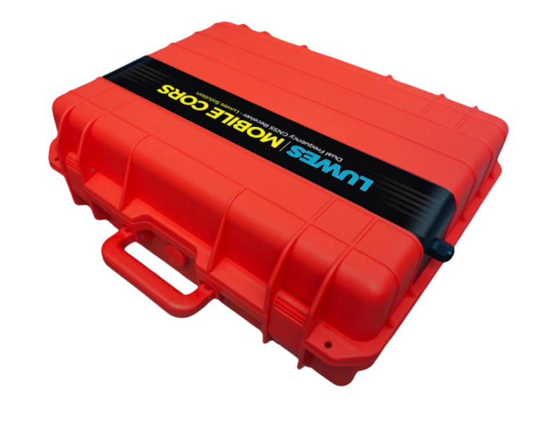
A continuously operating reference station system for precise positioning. Collects, records, and transmits GNSS data to enable real-time positioning with centimeter-level accuracy and supports both post-processing and real-time RTK workflows.
Key Capabilities:
- Operates as a continuously running GNSS geodetic reference network
- Real-time GNSS correction data transmission (RTCM format)
- Supports post-processing and real-time positioning workflows
- Continuous GNSS data collection, recording, and archival
Smartphone GNSS RTK
D303-RTK
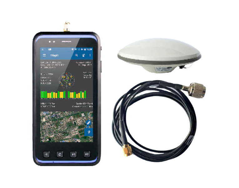
Android-based mobile GNSS RTK receiver with multi-constellation support for high-precision field surveying and GIS data collection. Integrates seamlessly with CORS network for real-time centimeter-level positioning.
Product Features:
- High positioning accuracy with multi-GNSS support (GPS, GLONASS, Galileo, BDS, QZSS)
- Android 5.1 OS for field configuration and usability
- WiFi and 4G LTE communication for real-time corrections
- Integration with GIS software for field survey and measurement
RTK Positioning Workflow
01 CORS Receives Signals
Mobile CORS base station continuously receives GNSS signals from multiple satellite constellations
02 Data Processing
System processes raw GNSS data and calculates position correction parameters
03 Correction Transmission
RTCM correction data transmitted via wireless network to RTK receivers
04 Precise Positioning
RTK receiver applies corrections to achieve centimeter-level accuracy
D303-RTK Technical Specifications
GNSS System
- Channels
- 250
- Constellations
- GPS, GLONASS, Galileo, BDS, QZSS
- Frequencies
- L1/L2, G1/G2, E1/E5b, B1/B2/B3
RTK Accuracy
- Horizontal
- 0.02 m + 1 ppm CEP
- Vertical
- 0.04 m + 1 ppm CEP
- Init Time
- 30 seconds
Communication
- WiFi
- 2.4/5GHz
- Cellular
- 4G LTE
- Bluetooth
- 4.0LE
Hardware
- Operating System
- Android 5.1 OS
- Display
- 5" Display 720p
- Protection
- IP65 Rated
Complete Technical Details
Platform & Storage
- Operating System
- Android 5.1
- CPU
- Quad-core 64 bits 1.3GHz
- RAM / Storage
- 2GB / 16GB (extendable)
Positioning Performance
- GNSS Mode
- GPS + GLONASS + Galileo • GPS + BDS + Galileo
- Time to First Fix
- Cold Start < 30s • Hot Start: 1s • Re-acq < 1s
- Output Rate
- 1Hz
Field Hardware
- Display / Touch
- 5" 1280×720 sunlight readable / Capacitive Multi-Touch
- Camera
- 13MP, autofocus, LED flash
- Battery
- 3.7V 3200mAh
Connectivity & Protection
- Cellular Network
- GSM: B2, B3, B8 • WCDMA: B1, B8 • TDD-LTE: B38, B39, B40 • FDD-LTE: B1, B3
- Interface
- 1× MicroUSB • 1× MicroSD (32GB) • 1× SMA (GNSS antenna)
- Protection Rating
- IP65, 1.2m drop resistant
Applications
Surveying & Mapping
Cadastral surveying, topographic mapping, geodetic control networks, and boundary demarcation with centimeter-level accuracy for professional surveying applications.
Geospatial Monitoring
Land deformation monitoring, ground subsidence tracking, structural movement detection, and geohazard assessment for infrastructure safety and environmental monitoring.
Infrastructure Monitoring
Dam displacement monitoring, bridge settlement tracking, building deformation assessment, and critical infrastructure health monitoring using precise positioning technology.
GIS Data Collection
Field data collection for GIS databases, asset mapping, utility network surveys, and spatial data acquisition for urban planning and resource management.
Deploy Precise GNSS Positioning
Contact us for consultation on monitoring systems, telemetry, dashboards, or IoT and SCADA integration tailored to your field conditions.