Weather Monitoring Solution
Measure weather conditions automatically to support planning and responses to extreme weather.

Complete Weather Solution
Complete Weather Monitoring Solution
Combine measurements from automatic weather stations (AWS) with Spire satellite data to review local conditions and regional forecasts.
Automatic Weather Station
AWS Hardware
Physical weather monitoring stations equipped with precision sensors for measuring meteorological parameters in real-time with automatic data transmission.
Real-time multi-parameter weather monitoring
High-accuracy sensors with ±0.2°C precision
Solar-powered with dual battery system
GSM/LoRa connectivity for remote areas
Satellite-Based Forecasting
Spire Weather Data
Satellite-based weather forecasting providing high-resolution (3km) weather predictions up to 6 days ahead covering all of Indonesia with hourly updates.
High-resolution 3km spatial coverage
Hourly forecasts up to 6 days ahead
Soil moisture analysis for agriculture
Satellite and ground data fusion
Integrated Solution Architecture
01
AWS Sensor
02
Spire Data
03
Luwes Platform
04
Insights
Platform Overview
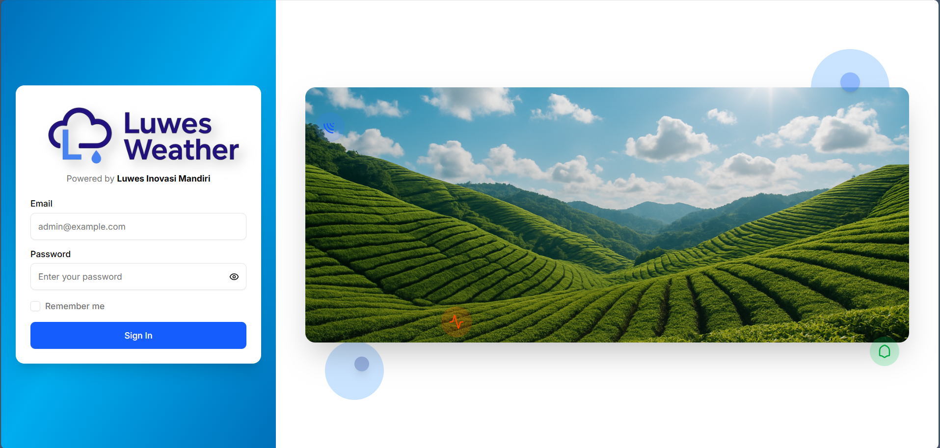
Luwes Weather Platform
View the latest weather readings, charts, and reports online with secure access from anywhere.
Real-Time Monitoring
Access live weather data and visualizations from your monitoring stations with automatic updates every minute.
Cloud-Based Access
Open the platform on a computer, tablet, or phone. Access permissions are managed for each user role.
Advanced Analytics
Comprehensive data analytics with historical trends, custom reports, and automated alert systems for critical conditions.
Hardware Component
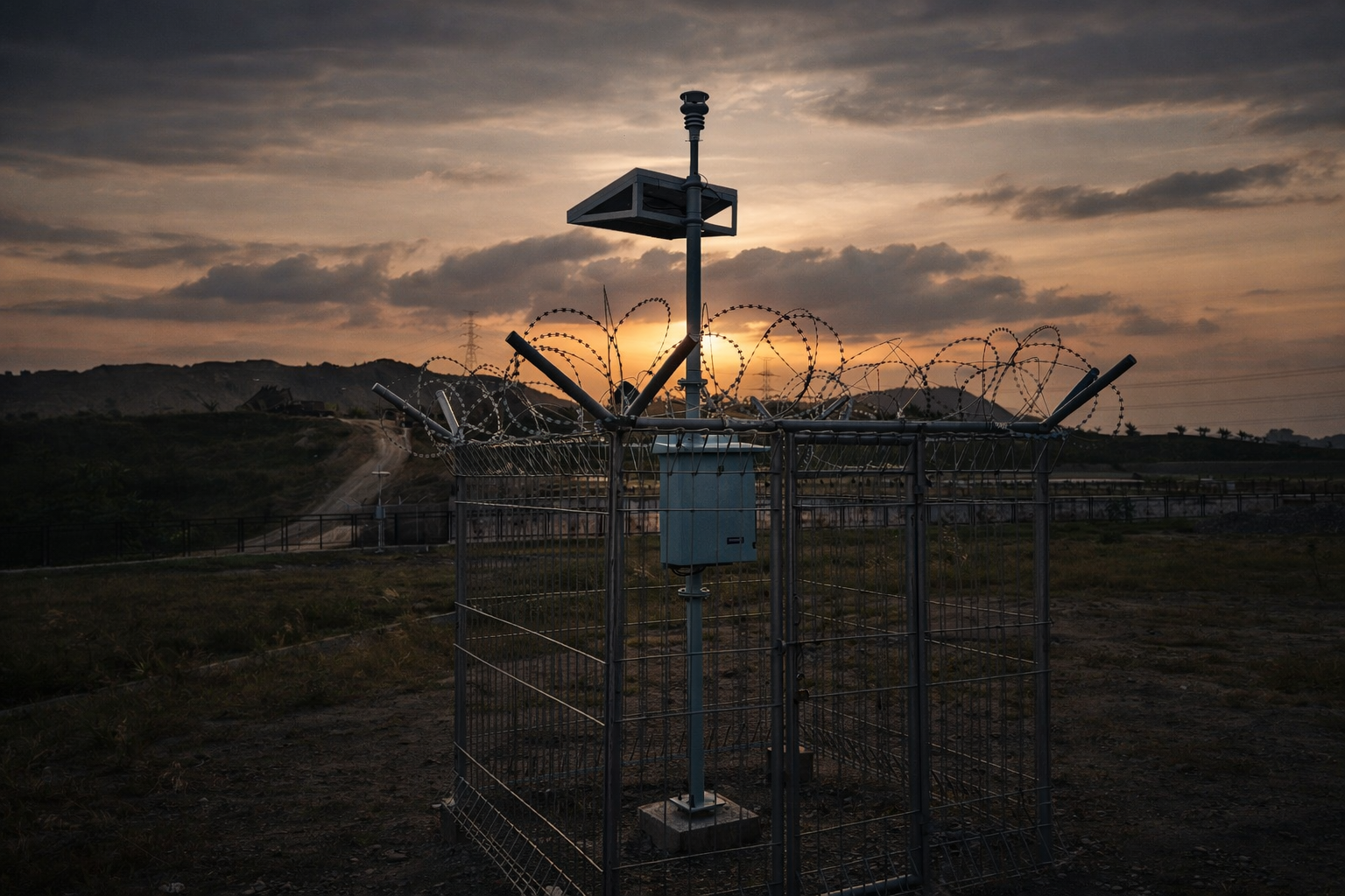
Automatic Weather Station (AWS)
Professional-grade automatic weather monitoring hardware with precision sensors and reliable data transmission.
Key Features
High Accuracy
High-quality sensors with precision calibration delivering accurate and reliable meteorological data with ±0.2°C temperature accuracy.
Solar Powered
Combination of 20WP solar panel and dual battery system (Lithium-Ion + VRLA) ensuring 24/7 operation without external power supply.
Multi-Protocol Connectivity
GSM, Bluetooth LE, and LoRa (AS923) communication protocols for reliable data transmission in various environments.
What the station measures
Air Temperature
Ambient air temperature measurement with range -40°C to +60°C and accuracy ±0.2°C
Air Humidity
Relative humidity monitoring 0-100% RH with accuracy ±2% RH
Wind Speed & Direction
Anemometer sensor to measure wind speed 0-70 m/s and wind direction 0-360°
Rainfall
Rain gauge with 0.2mm resolution for precise rainfall measurement
Air Pressure
Digital barometer with range 300-1100 hPa and accuracy ±0.5 hPa
Solar Radiation
Pyranometer to measure global solar radiation 0-1400 W/m²
Technical Specifications
Sensor & Measurement
- Communication:
- GSM, Bluetooth LE, LoRa (AS923)
- Memory:
- 16GB (Capacity > 5 years)
- Protection Level:
- IP67
- Temperature Range:
- -40°C to +60°C
- Humidity Range:
- 0-100% RH
- Wind Speed Range:
- 0-70 m/s
System & Power
- Rechargeable Battery:
- Lithium-Ion 3200mAh x 2 + VRLA 7.2Ah 12V x 2
- Solar Panel:
- 20 WP
- Power Consumption:
- 300mW
- Data Interval:
- 1 minute (adjustable)
- Operating Temp:
- -40~70°C
- Data Storage:
- >5 years capacity
Satellite Data Component
Detailed weather forecasts and soil moisture data
Weather and soil information for Indonesia
- 01
- Indonesia-wide coverage
- 02
- 3 km Resolution & Hourly Output
- 03
- Data Update 2× Daily
- 04
- Combines satellite and ground measurements
Indonesia National Coverage
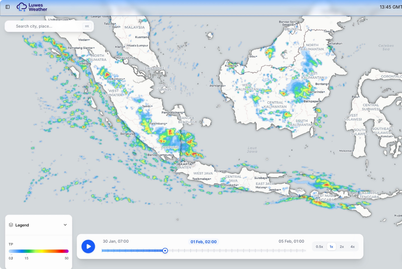
Full Indonesia Territory Coverage
Tropical Climate Optimized Model
Maritime and Land Surface Hybrid Modeling
- Coverage
- Indonesia Coverage
- Spatial Resolution
- Weather: ~3 km
- Soil Moisture:
- 6 km Global
- Soil Moisture:
- 500 m Regional
- Soil Moisture:
- 100 m detailed coverage
- Update schedule
- Forecasts: hourly
- Update schedule
- Updates: 2× per day
- Update schedule
- Forecast Horizon: Up to 6 Days
- Data Delivery
- REST API
- Data Delivery
- Web Map Visualization
- Data Delivery
- Raster Layer
- Data Delivery
- Dashboard Integration
Weather Forecast Parameters
Core Weather Parameters
Precipitation
Temperature
Wind at different heights
Relative Humidity
Cloud Cover
Solar Radiation
Advanced Atmospheric Parameters
CAPE, DCAPE, CIN
Vertical Wind Shear
Storm Helicity
LCL and LFC
Atmospheric Thickness
Atmospheric Anomaly Analysis
Soil moisture information
Main Parameters
Water content by soil volume
Soil moisture index
Moisture around plant roots
Surface moisture monitoring
Uses
Irrigation planning
Drought monitoring
Flood risk monitoring
Land Productivity Optimization
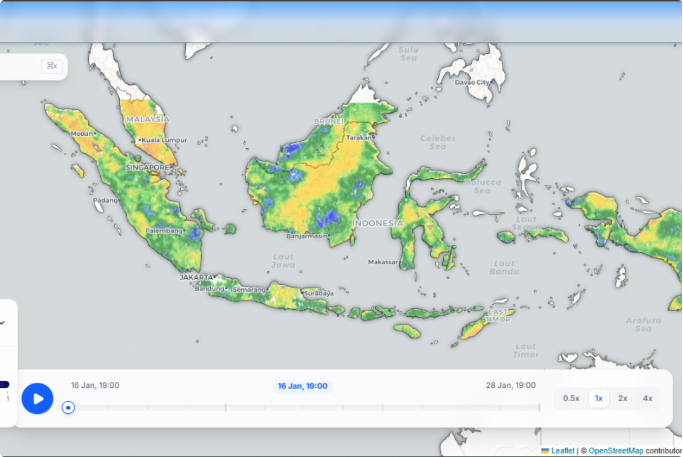
Data sources
Satellite Sources
GNSS-R Observation
Microwave Soil Moisture
Radar Satellite Observation
Atmospheric Sounding Data
Ground measurements
Weather station network
Rain gauge network
Environmental IoT Sensors
Hydrology and Soil Sensors
01
Satellite
02
Data Fusion
03
Model
04
Output
Applications & Usage
Our weather monitoring solutions serve various industries and applications with precision and reliability.
Agriculture
Irrigation optimization and planting scheduling
Airport
Flight safety and operations
Research
Climate and meteorology studies
Industry
Work environment condition monitoring
- Agriculture
- Government
- Disaster Mitigation
- Energy
- Aviation
- Maritime
- Smart City
Technology Advantage
Satellite observations
Stable forecasts over time
Reliable measurements
Connects to existing systems
Options for different industries
Information for planning and decisions
Complete Weather Solution
Plan with clearer weather and soil information
Let's discuss how we can help your business with the right IoT solutions